Dublin Core
Title
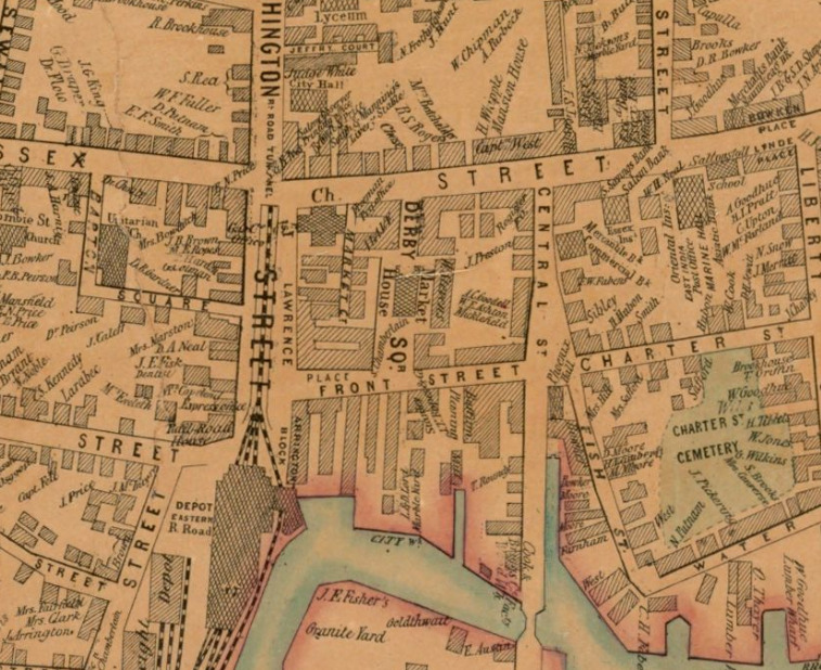
Front Street, from section of the 1851 map of Salem, Massachusetts
Subject
historic maps
Salem, Massachusetts
Description
A section of downtown Salem Massachusetts from 1851. Depicts streets, buildings, city blocks, railroads, the main railroad station, and the waterfront near South River. Businesses identified along Front Street include the Buffum Planning Mill, the L. & B. Lord Marble Works, and the Cook and Briggs Wood Works.
Creator
McIntyre. Henry, City Engineer
Taylor, H.E. B., assistant
Source
Norman B. Leventhal Map and Education Center
Boston Public Library
Publisher
McIntyre, Henry
Date
1851
Contributor
Brian Valimont
Rights
Norman B. Leventhal Map and Education Center
Boston Public Library
Format
paper map
Language
English
Type
still image
Coverage
1851
Still Image Item Type Metadata
Original Format
paper map
Physical Dimensions
90 by 91 cm
